This project presents a comprehensive reconstruction of the territory in the 12th microdistrict of the Lyublino district. A comprehensive analysis of the territory was conducted during the project development. Based on the collected data, design improvements were proposed.
Categorization
(01) General Information (02) Site Analysis (03) Strengths and Weaknesses (04) Design Proposals
01. Site Plan
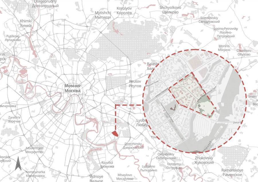
01. General Information
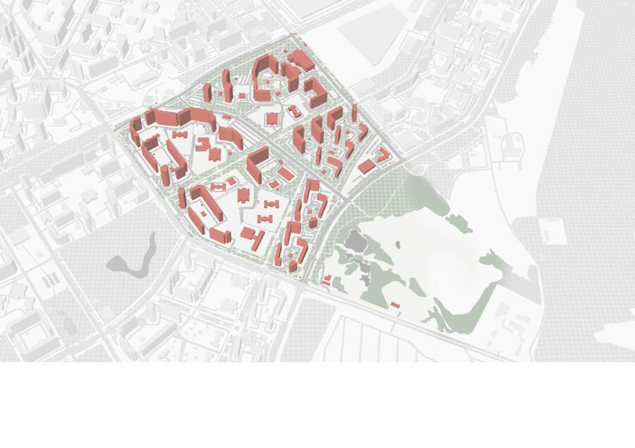
Location: 2nd micro-district of the Lyublino district (SEAO). Plot size: 107 hectares Absolute terrain elevations: 123–134 m Elevation difference: 11 m Population: ~8000 people
02. Historical Overview
The territory of the 12th microdistrict in Lyublino is located on the land of the former Lyublino Irrigation Fields—the largest water purification facilities of late 19th-century Moscow. The fields were established between 1892 and 1898 for the soil purification of municipal sewage and operated until 1978. After they closed, the area was reclaimed, and in the 1970s and 1980s, residential microdistricts were built on the site. The names of the streets, Verkhniye Polya and Nizhniye Polya, preserve the memory of the area’s historical past.
02. Photoanalysis
02. Functional Diagram
02. Transportation Scheme
02. Greenish-blue framework
03. Strengths and weaknesses of the area
+ Developed green infrastructure
+ Well-developed social infrastructure
+ Opportunities for walks and recreation
+ Excellent transportation access
+ Comfortable and safe environment
— Insufficient landscaping in the park area
— Lack of sanitation maintenance
— Conflict between recreational functions
— Ineffective use of the water body
— Blurry boundaries between urban and natural environments
— Absence of visual landmarks
— Inefficient use of green spaces
04. Project Proposals
- Formation of a Community Core— Develop a shared public core for the neighborhood — Design spaces for local events — Beautify the public area in the park
- Park Area Reorganization— Repurpose underutilized lawn spaces — Deconstruct the central continuous avenue — Delineate zones for active, sporting, and tranquil recreation — Enhance park safety through improved lighting
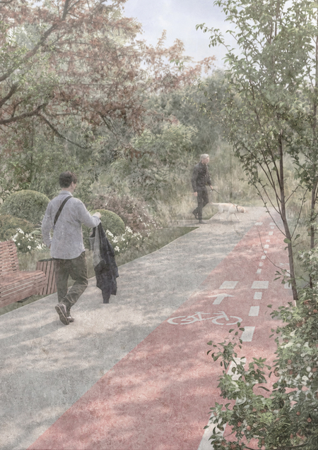
- Pedestrian and Recreational Structure— Separate transit and recreational routes — Establish comfortable connections between residential development and the park — Develop comfortable bicycle paths
- Unified Landscape Improvement System— Introduce a standardized system of small architectural forms — Develop a unified navigation system — Establish a coherent visual identity for the grounds
04. Area of Radical Reorganization